
GMA 395: GIS Mapping and Spatial Analysis
GMA 395: GIS Mapping and Spatial Analysis
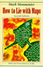
How to Lie With Maps
CSU Instructor Open Textbook Adoption Portrait
Abstract: This open textbook is being utilized in a Global Studies and Maritime Affairs course for undergraduate students by Katherine Sammler, Ph.D., at Cal State Maritime Academy. The textbook provides the fundamental concepts of cartographic theory and spatial thinking. The main motivation to adopt a reduced cost textbook was to save students money. Most students access the open textbook in paperback form.
About the Textbook
Description:
To show how maps distort, this book introduces basic principles of mapmaking, gives entertaining examples of the misuse of maps in situations from zoning disputes to census reports, and covers all the typical kinds of distortions from deliberate oversimplifications to the misleading use of color.
Originally published to wide acclaim, this lively, cleverly illustrated essay on the use and abuse of maps teaches us how to evaluate maps critically and promotes a healthy skepticism about these easy-to-manipulate models of reality. Monmonier shows that, despite their immense value, maps lie. In fact, they must.
Authors:
- Mark Monmonier - Syracuse University
Formats:
This book is available as a paperback. The second edition is also available as a free downloadable PDF.
Supplemental resources:
I included select chapters from Edward Tufte books, including "The Visual Display of Quantitative Information” (2001) and "Envisioning Information” (1990). I kept the page numbers within copyright range.
Cost savings:
I gave the students the choice of using the first edition of this text ($4.75 on Amazon) and the second edition ($14.68). Since I teach about 48 students each year, using the older version of the text saved the students about $477. If students chose to use the free PDF instead of the second edition, the total cost savings for students would be $705.
License:
This book does not have a Creative Commons license. It is copyrighted.
About the Course

GMA 395: GIS Mapping & Spatial Analysis
Description:
This course develops a powerful skill set using geographic information system (GIS) software to visualize, question, analyze, and interpret data to understand relationships, patterns, and trends in geopolitics, transportation, logistics, communication, marine spatial planning, ocean and coastal science. This introductory mapping course teaches the skills necessary for data visualization and spatial analysis. Students learn ArcGIS and related software while engaging in hands-on training in the creation of digital maps. ArcGIS is a standard software for industries, government institutions, and NGOs. Skills will be practiced through computer lab assignments as well as producing original maps based on student interests, which may be used for other class projects, research papers, or personal projects.
Prerequisites: None
Learning outcomes:
- SLO1 Explain fundamental elements of maps
- SLO2 Evaluate map generalization, representation, and cartographic error
- SLO3 Critique mapping practices, techniques, data, and visual communication
- SLO4 Communicate clear and comprehensive written, visual, and oral arguments
- SLO5 Create interesting and unique digital and printable maps
Curricular changes:
This was the first time this course has been taught on this campus, so there were no curricular changes.
Teaching and learning impacts:
Collaborate more with other faculty: No
Use wider range of teaching materials: Yes
Student learning improved: Unsure
Student retention improved: Unsure
Any unexpected results: No
We used many New York Times articles with maps and visual data graphics to explore the possibilities for data visualization.
Sample assignment and syllabus:
This is one of the assignments I used
This is the syllabus I used for this class.
Textbook Adoption
OER Adoption Process
This is a newly developed class on campus, so there are no used books from previous iterations of the class for students to buy. Some GIS texts can be very expensive, and students have some added costs in the printing and compilation of a map portfolio that is the final project for this class. I wanted to start this class out with the best cost saving practices possible. I hope this will carry through as this class gets adopted into the regular curriclum.
Student access:
Students could purchase a very inexpensive used copy of the old edition of this classic geography text. They also have access to a free e-book that can be downloaded as a PDF.
I am a Global Studies and Maritimes Affairs professor at the Cal State Maritime University. I teach Ocean Politics, Comparative Maritime Policies, Environmental Policy, and GIS Mapping & Spatial Analysis.
I attempt to integrate unique and wide-ranging interests in both the social sciences and physical sciences into my courses. My teaching philosophy focuses on fostering critical thinking in a way that is applicable towards problems at the convergence of political and environmental issues. While it is always a challenge to weave diverse epistemological perspectives into strategic problem-solving methods, I think such assets will benefit students by incorporating theoretical and practical aspects of learning and performing. I have developed a teaching approach that embraces the diverse learning styles, background knowledges, experiences, and goals of building practical skills and intellectual rigor. I strive to create an environment that respects a diffuse and inclusive balance of power in the classroom. Whether engaging in hand-on activities or discussing a reading assignment, I venture to embolden students by promoting a classroom that constitutes a laboratory of ideas, hypotheses and inquiry.
My research has focused on policies and practices emerging around seabed mining governance in New Zealand and the broader South Pacific. As onshore resource production struggles to meed global demands, the world is turning offshore to meet food, fuel and mineral needs. Expanding jurisdictional claims have created the legal space for development to creep into ocean spaces, putting precious and life sustaining ecosystems under yet another human pressure. Recent extension of national space into the ocean is challenging conventional institutions of governance and necessitating new management regimes, prompting concerns over economic fairness and environmental impacts. South Pacific nations are presumed to have the most to gain from developing their seabed resources given their geologic positioning and large ocean to land territorial ratios.
More recently I have been moving my research in new directions related to the intersection of polar and maritime policy, seabed mining, air and space governance, and the techniques for asserting power over and within these spaces. I aim to investigate the significance and influence of a range of technological advances, expanding human activities, and capital investments, as these factors challenge the political and legal constructions of maritime and outer space, and the atmosphere in between. Focusing on the conceptualization of these spaces as constitutive of a 'vertical commons' this research will critique the ways in, and extent to, which these volumetric spaces that lie supposedly beyond the reach of sovereign states are becoming increasingly sought after to provide offshore, and off-planet, resources and maritime, aerial and extra-terrestrial territorial security.